FREE UK delivery when you spend £50 - see more delivery options.

Homepage / GPS / Handheld GPS / Garmin Oregon 700
Product Codes: GARO700
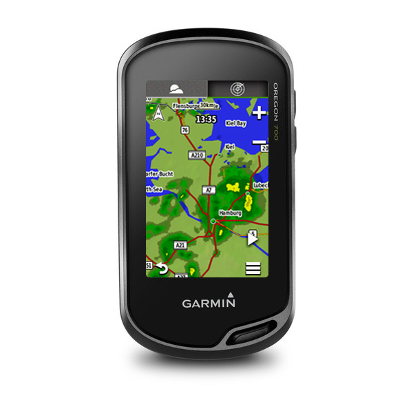
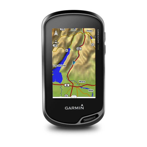
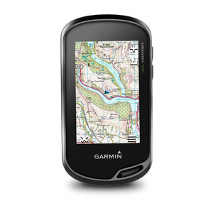
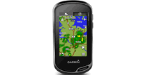
The Garmin Oregon 700 is the latest handheld GPS device from Garmin which features a 3-inch sunlight-readable touchscreen. The device has a dual-orientation mode and also features an altimeter, barometer and compass. It also has Multilink wireless connectivity whereby it uses WiFi, Bluetooth and ANT+ technology.
Add mapping to the Garmin Oregon 700 such as BlueCharts for use on the water and City Navigator maps for use when driving.
![]()
Garmin Oregon 700 has been discontinued.
View latest handheld GPS.
Buy Garmin Oregon 700 accessories
 Deliveries
We offer UK, Europe and Worldwide deliveries. We despatch orders at 4:30pm on Monday, Tuesday, Wednesday, Thursday and Friday. We need to receive your order on those days by 3:00pm. When possible we may despatch orders received after that time. No orders are despatched on Saturday, Sunday or Bank Holidays in England and Wales.
We offer FREE UK delivery on all orders of £50.00 or more, plus next working day and guaranteed Saturday delivery options. Click here for further info. All options also appear at the basket pages.
 The Garmin Oregon 700 is a Garmin handheld GPS device with a 3-inch sunlight-readable touchscreen. 1 -year subscription to BirdsEye Satellite Imagery is included. It features an enhanced antenna for receiving the GPS or GLONASS signal. Built-in WiFi enables easy transfer of data between Garmin devices (using Garmin Connect feature). Active Weather is also available on the move when connecte to a mobile phone with 4g access.
If you would like a built-in digital camera then you should buy the Garmin Oregon 750 instead. Also note when buying the Garmin Oregon 700 no AC Charger is included and there is no rechargeable battery pack wherease these accessories are standard items in the box when buying the Oregon 750 or Oregon 750t. A further limitation of the Garmin Oregon 700 is that the built-in memory is 1.7GB compared with 4.0GB with the Oregon 750 and 750t.
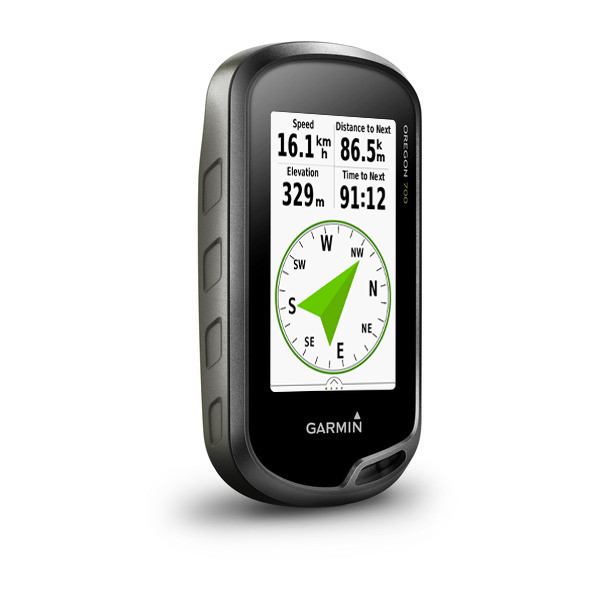
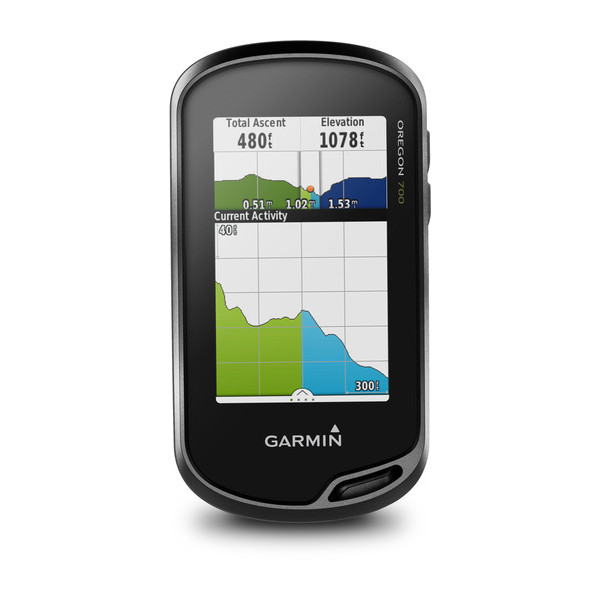
The Garmin Oregon 700 includes altimeter, barometer and compass to provide important information whilst on your journey:
‣ Altimeter - elevation data, ascent, descent
‣ Barometer - predict weather changes (short term trends in air pressure)
‣ Compass (3-axis) - keeps your bearing
Dual orientation feature is also available on the Garmin 700 enabling you to view the device in portrait or landscape mode.
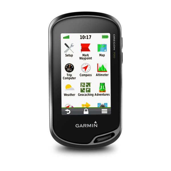
The Garmin Oregon 700 is a device for hiking, biking, geocaching, climbing, kayaking and trail riding. Multilink wireless connectivity is also built in to the Garmin 700 including WiFi, Bluetooth and ANT+). With these technologies you can receive smart notifications (receive emails, texts and alerts on the Garmin device), view active weather radar, view LiveTrack location data, discover Geocaches (Automatically update device with latest caches. No more manual entries.), update software, upload to Garmin Connect. You can also upload and share your favourite photos with friends via Garmin Adventures (Garmin online community).
The Garmin Oregon 700 has a dual battery system whereby you can use either AA Batteries or rechargeable NiMH power pack. The battery life is upto 16 hours.
With the included BaseCamp software you can view and organise maps, waypoints, routes and tracks. There is also trip-planning software whereby you can also use Garmin Adventures to share routes, waypoints and tracks with friends, family or fellow explorers. BaseCamp also displays topographic map data on you computer screen such as contour lines and elevation profiles. You will also have access to an almost unlimited amount of satellite images to your device using the included 1-year BirdsEye Satellite Imagery.
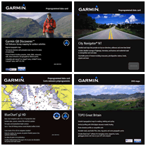 Add maps and charts to the Oregon 700. Mapping options include: City Navigator street-level road maps, BlueChart g3 marine charts, TOPO maps and GB Discoverer Ordnance Survey LandRanger maps at 1:25k or 1:50k scale. Each of these maps are available on SD/microSD Card. View optional maps for the Oregon 700.
The device also offers paperless geocaching providing full descriptions, cache photos, hints and logs and can store up to four million geochaches!
Do you have a question about the Garmin Oregon 700 or other handheld GPS related question that's not been answered on this webpage? Please see our handheld and Outdoor GPS FAQs page for questions from other customers.Plus if the answer to your question isn't featured, use the online form to ask us for the answer. Alternatively please telephone 01733 777623 Monday to Friday (9:30am-5:00pm) to speak to one of our sales team. For further information online please see the Garmin Oregon comparison table.
‣3-inch transflective colour TFT touchscreen display
‣Dual Orientation display
‣Built-in basemap with DEM (Digital Elevation Model) data
‣Stores 10,000 waypoints and 250 routes
‣Garmin Connect IQ allows you to change the style of the screen
‣Active Weather available with 4g access
‣WiFi compatibility
‣Garmin Connect compatibility to share route routes and eaypoints
‣Stores distance, speed recorded which can be shared using Garmin Connect
‣Provides automatic turn-by-turn directions with optional City Navigator maps
‣High-sensitivity GPS receiver with HotFix for improved performance and reception
‣3-axis tilt-compensated electronic compass
‣Barometric altimeter
‣Easy-to-use, touchscreen interface
‣Waterproof standard: IEC 60529 IPX7
‣4GB internal memory for map data and photos
‣Wirelessly share routes, tracks, waypoints and geocaches between units
‣microSD card slot for additional map data
‣Rechargeable NiMH pack (included) provide 16 hour battery life or power via 2 AA batteries (not included)
‣Weighs 209.8grams with batteries
‣High-speed USB and NMEA 0183 compatible
‣2 year guarantee
Garmin Oregon 700 is preloaded with a worldwide basemap with shaded relief. Additional pre-programmed Garmin maps on SD/microSD card can also be added including TOPO maps of 1:50K Great Britain, 1:25K Great Britain, France, Italy, Spain, etc. Learn more about the available maps for the Oregon 700.
‣Oregon 700
‣USB cable
‣Carabiner clip
‣Documentation
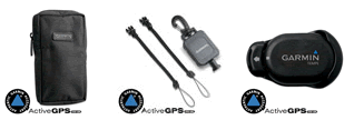
Looking for accessories to use with the Garmin Oregon 700 handheld device? We sell a vast selection of genuine parts and spares including Oregon 700 hard carrying case, belt clip, handlebar mount and vehicle power cable and mount.
View all Garmin Oregon 700 accessories
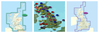
Garmin Oregon 650t is preloaded with topographical maps for UK and Europe. However, a number of other maps supplied on SD/microSD Card are also compatible including street-level road maps - perfect for cycling of using your Oregon 650t in a car, 1:50k and 1:25k Ordnance Survey maps - ideal for hiking and walking the countryside of Great Britain and marine BlueCharts - ideal if you want to navigate the waters around the UK, Europe or further afield.
View all Garmin Oregon 700 maps
‣Technology: GPS
‣Display: 240 x 400 pixels, transflective colour TFT touchscreen
‣Touchscreen: Yes
‣Waypoints: 10,000
‣Routes: 250
‣Track log: 20,000 points, 250 saved tracks
‣Built-in memory: 1.7GB
‣Altimeter: Yes
‣Electronic compass: Yes
‣Barometric altimeter: Yes
‣Data cards: microSD card
‣Battery: rechargeable NiMH pack (optional) or 2 AA batteries (not included); NiMH or Lithium recommended
‣Waterproof: Yes (IPX7)
‣Dimensions: Width - 61mm, Height - 114mm, Depth - 33mm
‣Weight: 209.8 g with batteries
‣Guarantee: 2-year
‣Garmin Oregon 700 manual
![]() Manual requires Adobe Acrobat Reader
Manual requires Adobe Acrobat Reader
Download a free copy here
This is a sophisticated electronic device. It is important to read, understand, and follow the instructions provided in the user manual (usually available via the 'manual' link above). To ensure optimal performance, you will need internet access and should regularly download and install firmware and software updates as recommended by the manufacturer. Like all GPS devices, it requires a clear view of the sky to connect with satellites, so be aware that certain vehicle glass or enclosures may block or reduce GPS signal reception.
Updates for this device are delivered via the internet. This page provides information on compatibility with current devices such as PCs, laptops, Macs, and smartphones. Under the Consumer Contract Regulations, you have 14 days from receipt of purchase to verify compatibility with your internet-connected device. Please note that if you later replace or upgrade your PC, Mac, or smartphone, neither ActiveGPS nor the manufacturer can guarantee compatibility with the new operating system.
Why Buy from ActiveGPS?We are official authorised Garmin Internet Retailers, offering genuine Garmin products, accessories, and maps. All our stock is purchased directly from assigned Garmin UK distributors - we do not source from the grey market and never sell counterfeit products.
When you buy from ActiveGPS.co.uk, you can be confident that you’ll receive full Garmin support and the peace of mind that comes with purchasing authentic, reliable products.
Page updated: 2nd January 2026
ActiveGPS.co.uk
Customer Service
Telephone Number:
01733 777623
Monday to Friday 9:30am to 5:00pm (UK Time)
Follow us on
![]()
![]()
![]()
![]()
![]()

ActiveGPS.co.uk Copyright © Active Alliance Limited 2005-2026 | Company Number - 05200677 | VAT Number - GB 834 2222 57
Text compiled by and copyright Active Alliance Ltd. Plagiarism software in use - do not copy any of our website text, images or videos.