FREE UK delivery when you spend £50 - see more delivery options.

Homepage / GPS / Handheld GPS / Garmin Maps / Garmin TOPO Maps
Product Code: GARTOM2
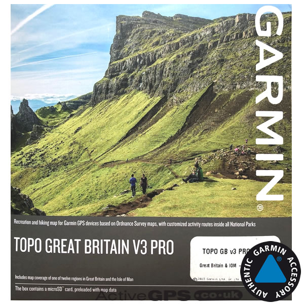
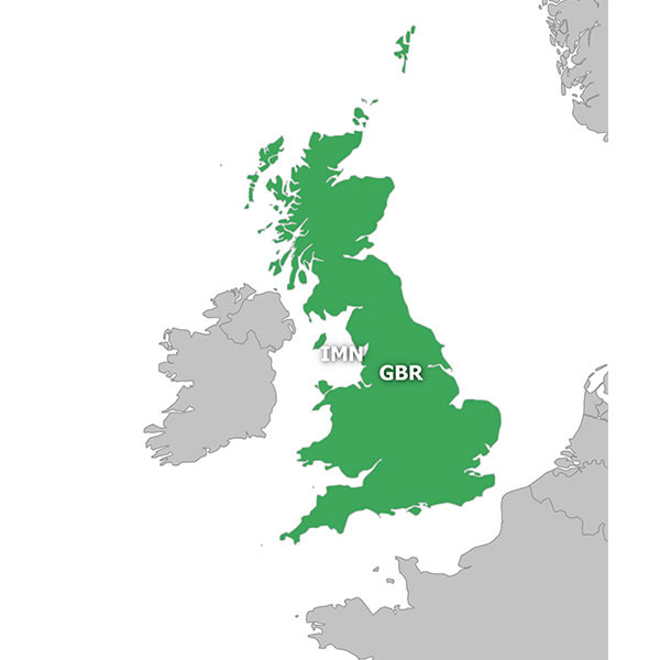
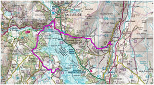
Explore the British countryside with clear, easy-to-read mapping using the Garmin TOPO Great Britain V3 PRO 1:50K microSD/SD card. Designed for outdoor navigation, route planning, and general exploration, this map delivers official Ordnance Survey (OS) Landranger coverage of England, Scotland, Wales, and the Isle of Man directly on your compatible Garmin handheld or outdoor GPS device.
The map arrives preloaded on a convenient plug-and-play SD/microSD card. Simply insert it into your device’s SD card slot, select the map on-screen, and start navigating roads, trails, and open countryside across Great Britain.
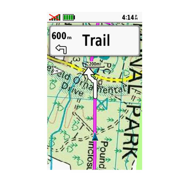
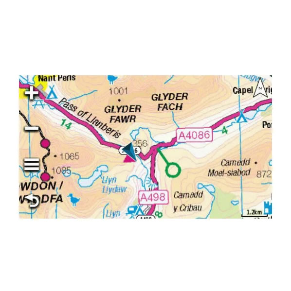
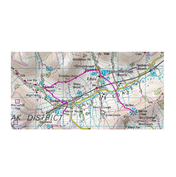
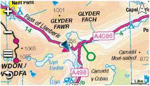
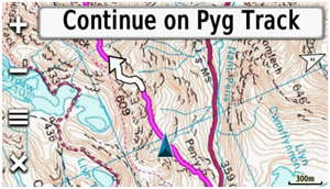
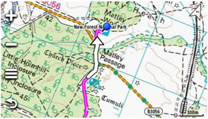
Featuring a 1:50K scale, this version provides excellent balance between detail and wide-area coverage, making it ideal for cycling, trail riding, and general outdoor use. The map includes contour lines, terrain features, and ActiveRouting for paths and trails across 15 National Parks, helping you plan and follow routes with confidence.
Garmin part number: 010-12772-02
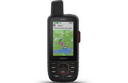
The Garmin TOPO Great Britain V3 PRO 1:50K microSD/SD card is compatible with a wide range of Garmin handheld and outdoor GPS devices. For a full list of supported models, including Garmin Montana, Oregon, eTrex, and GPSMAP series, scroll down to view detailed compatibility information.
Please note: This is mapping software only. You will need a compatible Garmin device (or purchase one here). Your device may require the latest software update. Further installation tips for Garmin maps are available.
![]()
Garmin TOPO Great Britain V3 PRO 1:50K microSD/SD card - £149.99
 Deliveries
We offer UK, Europe and Worldwide deliveries. We despatch orders at 4:30pm on Monday, Tuesday, Wednesday, Thursday and Friday. We need to receive your order on those days by 3:00pm. When possible we may despatch orders received after that time. No orders are despatched on Saturday, Sunday or Bank Holidays in England and Wales.
We offer FREE UK delivery on all orders of £50.00 or more, plus next working day and guaranteed Saturday delivery options. Click here for further info. All options also appear at the basket pages.
Garmin TOPO Great Britain PRO 1:50K V3 is ideal for exploring the countryside across England, Scotland and Wales. Designed for general outdoor navigation and route planning, it delivers clear, easy-to-read recreational mapping displayed directly on your compatible Garmin handheld or outdoor GPS device.
The SD/microSD card comes preloaded with full topographic coverage of Great Britain at both 1:50K and 1:250K scales, along with coverage of the Isle of Man at 1:25K.
We supply the latest version of Garmin TOPO Great Britain PRO 1:50K — V3 (Version 3), Garmin part number 010-12772-02. Be aware that some sellers still offer older editions, including Version 2 (V2) released in 2021 and Version 1 (V1) released in 2017. Both earlier versions are shown below for comparison. The current V3 1:50K map was released in December 2023 and features updated mapping data (copyright 2023).
If you require Ordnance Survey mapping at a more detailed 1:25K scale across all of Great Britain, the Garmin TOPO Great Britain PRO 1:25K microSD/SD card is also available and was released in December 2023.

In addition to topographic mapping, the GB TOPO 1:50K map supports turn-by-turn street navigation on more than 520,000 km (over 320,000 miles) of roads, using data provided by HERE Maps.
Want more detailed paths for hiking and walking? Explore the Garmin TOPO Great Britain V3 PRO 1:25K map, perfect for trails, footpaths, and National Park navigation.
Garmin TOPO Great Britain PRO 1:50K V3 includes official Ordnance Survey (OS) mapping at 1:50,000 and 1:250,000 scales, delivering full topographic coverage of Great Britain on a single SD/microSD card. It also offers on-trail guidance using the OS Detailed Path Network, covering more than 53,000 km of paths and trails across all British National Parks.
In addition, the map features a wide range of searchable destinations, with over 570,000 searchable addresses and points of interest. These include accommodation, restaurants, car parks, banks, petrol stations, attractions, campsites, and many other useful locations for outdoor and everyday navigation.
¹Full ActiveRouting functionality is available only on selected devices and depends on the Garmin GPS model and installed software version.
‣SD card adaptor with preprogrammed microSD card inside
Garmin TOPO Great Britain PRO 1:50K V3 provides full topographic coverage of Great Britain at 1:50K and 1:250K scales, along with coverage of the Isle of Man at 1:25K. The map also includes routable road data for both Great Britain and the Isle of Man, supporting turn-by-turn navigation on compatible devices.
ActiveRouting offers routable paths and trails within the following National Parks:
If you require Ordnance Survey mapping at a more detailed 1:25K scale across all of Great Britain, please see the Garmin TOPO Great Britain PRO V3 1:25K map.
 The Garmin TOPO Great Britain V3 PRO 1:50K map on SD/microSD card is compatible with a wide range of Garmin handheld, outdoor, and cycling GPS devices. Key compatible models include:
We are now selling the latest Garmin TOPO Great Britain V3 PRO 1:50K microSD/SD card, released December 2023 with copyright 2023 map data. Older versions include V2 (010-12772-01, May 2021) and V1 (010-12772-00, 2017). This preloaded map provides full topographic coverage across all of Great Britain and the Isle of Man.
Garmin TOPO Great Britain V3 PRO mapping comes preloaded on a microSD card, which is supplied inside a larger SD card adapter. To install, insert either the full-size SD card or the microSD card (depending on your device) into your Garmin’s SD card slot.
Once the card is inserted, switch on your Garmin GPS device and navigate to the Maps menu via the on-screen interface. Locate the description for the new UK and Ireland map and select it by placing a tick alongside the map name. The map is now installed and ready to use.
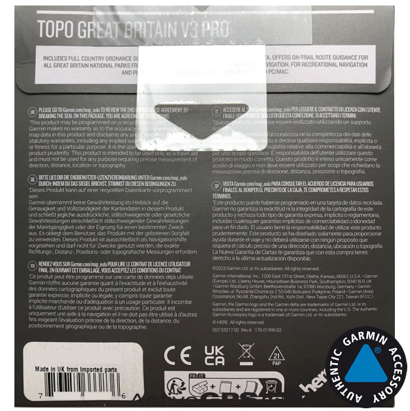
Please note: The SD card must remain in your Garmin device at all times for the map to function. The map cannot be copied to your Garmin unit or an external hard drive. However, the same SD card can be used in multiple compatible Garmin devices, one device at a time.
For further guidance, see help with installing and loading Garmin SD/microSD cards.
Depending on your Garmin device, there are several other Garmin map series available. Each series offers unique features tailored for different activities, from hiking and walking to street navigation and marine use.
 Garmin City Navigator maps provide detailed street-level road mapping for your Garmin device, making them perfect for car, motorcycle, and camper navigation. Coverage is available worldwide, including Full Europe, North America, Middle East and Northern Africa and other regions. Each map comes preloaded on a convenient plug-and-play SD or microSD card, allowing for easy installation and instant use in all compatible Garmin devices. These maps also include turn-by-turn directions, address search, and points of interest, helping you navigate confidently wherever you go.
View the full range of Garmin City Navigator maps.
 Garmin BlueChart maps are specially designed for marine navigation, making them ideal for use on rivers, lakes, coastal waters, or offshore voyages. These charts provide detailed mapping, including water depths, navigation aids, hazards, ports, marinas, and other essential information to help you plan and navigate your route safely. Available in a variety of sizes from small to extra-large, Garmin BlueChart maps let you choose the coverage that suits the waters you plan to explore by boat, yacht, dinghy, or RIB. Perfect for both recreational sailors and professional mariners, they integrate seamlessly with compatible Garmin handheld or chartplotter devices.
Learn more about Garmin BlueChart mapping and find the right chart for your next adventure.
Question: I am after some mapping software for my new Garmin etrex 35 touch and am thinking of your 1:50k TOPO map of GB. I would like the 1:25K but the price difference is quite substantial. My questions are:
1) Are your maps vector or raster?
2) How up to date are the maps that you have for sale on your website?
3) Would 1:50K be sufficient to follow footpaths and cycle paths?
Answer: In answering your questions:
1) Are your maps vector or raster?
I can confirm that the Garmin TOPO Great Britain V3 PRO 1:50K and 1:25K titles both feature vector-based mapping.
2) How up to date are the maps that you have for sale on your website?
We stock the very latest version of both Garmin TOPO Great Britain map titles.
3) Would 1:50K be sufficient to follow footpaths and cycle paths?
Garmin TOPO Great Britain V3 PRO 1:50K are equivalent to Ordnance Survey (OS) Landranger maps (pink) series.
Garmin TOPO Great Britain V3 PRO 1:25K are equivalent to Ordnance Survey (OS) Explorer maps (orange) series.
Please check to confirm which level of detail you require. The Garmin TOPO Great Britain V3 PRO 1:25K map features both the 1:25K and 1:50K maps. The 1:50K is pixilated beyond the included 1:50K map scale.
Do you have a question about the Garmin TOPO Great Britain V3 PRO 1:50K? Submit your question via our contact page.
 Why Buy from ActiveGPS?
We are official authorised Garmin Internet Retailers, offering genuine Garmin products, accessories, and maps. All our stock is purchased directly from assigned Garmin UK distributors - we do not source from the grey market and never sell counterfeit products.
When you buy from ActiveGPS.co.uk, you can be confident that you’ll receive full Garmin support and the peace of mind that comes with purchasing authentic, reliable products.
This page was last updated on: 27th January 2026
ActiveGPS.co.uk
Customer Service
Telephone Number:
01733 777623
Monday to Friday 9:30am to 5:00pm (UK Time)
Follow us on
![]()
![]()
![]()
![]()
![]()

ActiveGPS.co.uk Copyright © Active Alliance Limited 2005-2026 | Company Number - 05200677 | VAT Number - GB 834 2222 57
Text compiled by and copyright Active Alliance Ltd. Plagiarism software in use - do not copy any of our website text, images or videos.