FREE UK delivery when you spend £50 - see more delivery options.

Homepage / Marine / Garmin BlueChart / Garmin BlueChart g3 and g3 Vision
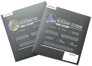
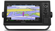
Garmin have released a new version of their popular BlueChart marine cartography series. The new BlueChart marine charts named BlueChart g3 and BlueChart g2 Vision were released in February 2019 and will be compatible with Garmin marine products e.g. their chartplotter range.
Garmin have released UK, European and North America BlueChart g3 coverage charts. Further world regions will be available in November 2019.
Garmin BlueChart g3 and g3 Vision charts are now available to purchase from ActiveGPS.co.uk website.
‣View UK and Europe Small g3 Vision charts
‣View UK and Europe Regular g3 charts
‣View UK and Europe Regular g3 Vision charts
‣View UK and Europe Large g3 Vision charts
‣North America Regular g3 charts
‣North America Regular g3 Vision charts
‣North America Large g3 Vision charts

 The new BlueChart g3 version replace the current and out-going Garmin BlueChart g2 HD and BlueChart g2 HD Vision marine cartography series. The new marine chart data features Garmin (coastal and seas navigation) and Navionics content (inland waters), providing industry-leading coverage, clarity and detail.
ActiveGPS are now selling the new BlueChart g3 charts by Garmin.
‣Industry-leading coverage, clarity and detail with new charts that feature integrated Garmin and Navionics content
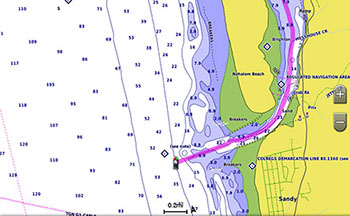
‣Auto Guidance quickly calculates a suggested route by using your desired depth and overhead clearance
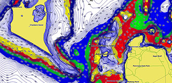
‣Includes Depth Range Shading for up to 10 depth ranges, enabling you to view your target depth at a glance
‣Up to 30 cm (1 ft) contours provide a more accurate depiction of the bottom structure for improved fishing charts
‣To give a clear picture of shallow waters to avoid, the Shallow Water Shading feature allows for shading at a user-defined depth
‣Genuine Garmin map product
Garmin now own Navionics which has enabled them to include Inland Waters in additional to the data previously offered by their Coastal and Sea waters BlueCharts.
Whether you are fishing or cruising, select a spot, and get a route showing you the general path and nearby obstructions at a safe depth.
This feature displays high-resolution Depth Range Shading for up to 10 depth ranges, so you can view your designated target depth.
To give a clear picture of shallow waters to avoid, this feature allows for shading at a user-defined depth.
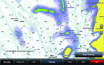
BlueChart g3 charts feature 30cm (1 foot) contours that provide a more accurate depiction of bottom structure for improved fishing charts and enhanced detail in swamps, canals and port plans.
 Garmin BlueChart Deliveries ONLY
Garmin BlueChart titles available to buy from AcrtiveGPS.co.uk are Special Order items and can take 7 days or more to arrive into stock. This is in part to ensure you receive the very latest version of the Garmin marine chart for your device, which is currently v2025. All of our Garmin BlueChart titles are made to order and require ordering from Garmin.
We offer FREE UK delivery on all orders of £50.00 or more. View all delivery options. Delivery options also appear at the basket pages.
 Why Buy from ActiveGPS?
We are official authorised Garmin Internet Retailers, offering genuine Garmin products, accessories, and maps. All our stock is purchased directly from assigned Garmin UK distributors - we do not source from the grey market and never sell counterfeit products.
When you buy from ActiveGPS.co.uk, you can be confident that you’ll receive full Garmin support and the peace of mind that comes with purchasing authentic, reliable products.
This page was last updated on: 2nd January 2026
ActiveGPS.co.uk
Customer Service
Telephone Number:
01733 777623
Monday to Friday 9:30am to 5:00pm (UK Time)
Follow us on
![]()
![]()
![]()
![]()
![]()

ActiveGPS.co.uk Copyright © Active Alliance Limited 2005-2026 | Company Number - 05200677 | VAT Number - GB 834 2222 57
Text compiled by and copyright Active Alliance Ltd. Plagiarism software in use - do not copy any of our website text, images or videos.