FREE UK delivery when you spend £40 - see more delivery options.
Homepage / GPS / Handheld GPS / Garmin Montana 680t
Product Codes: GARM680T
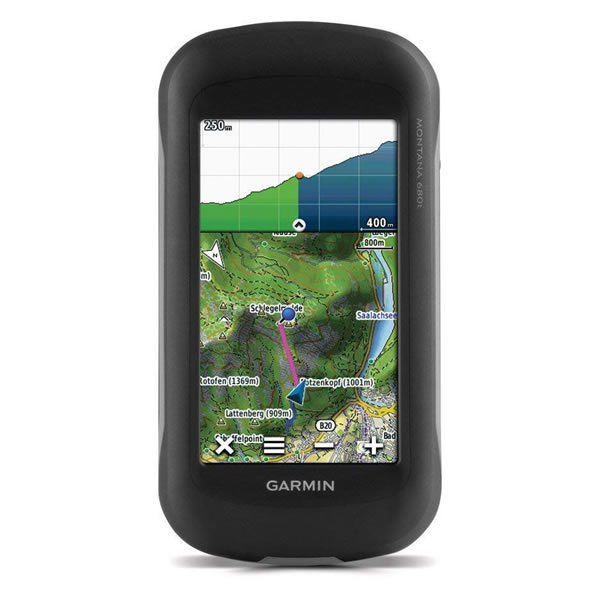
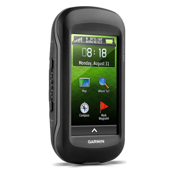
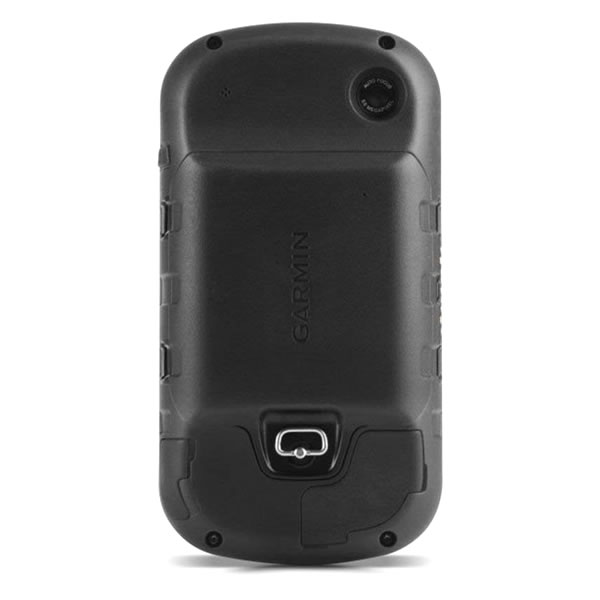
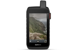
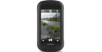
Garmin Montana 680t handheld GPS device is the perfect partner for walking/hiking. Plus with additional maps and mounts can also be used when driving, cycling and sailing too. Featuring a 4-inch colour touchscreen, the Montana 680t can be viewed either in landscape or portrait orientation.
The Montana 680t is preloaded with European topo map data and includes a 3-axis electronic compass and barometric altimeter. The Montana 680t, like the Montana 680 also includes a built-in 8 megapixel digital camera which geotags your photos with the location so you can view and navigate back to them in future.
![]()
Garmin Montana 680t has been discontinued.
Accessories are available for the Garmin Montana 680t. Likewise as are Garmin Montana 680t maps.
View latest handhelds.
The replacement model is the Garmin Montana 750i.
 Deliveries
We offer UK, Europe and Worldwide deliveries. We despatch orders at 5.30pm on Monday, Tuesday, Wednesday, Thursday and Friday. We need to receive your order on those days by 4.30pm. When possible we may despatch orders received after that time. No orders are despatched after 5.30pm and no orders are despatched on Saturday or Sunday.
We offer FREE UK delivery on all orders of £40.00 or more, plus next working day and guaranteed Saturday delivery options. Click here for further info. All options also appear at the basket pages.
 Garmin Montana 680T is a very versatile GPS satnav device that is durable and waterproof to IPX7 standards. There is a 4-inch touchscreen which is dual orientation and the Montana also includes a recreational/topographical map of Europe. Use the Montana 680T on a bicycle, 4x4, boats, handheld, in-car, motorcycle or on an All Terrain Vehicle. It can be operated in all conditions withstanding bumps, dust, dirt, humidity and water.
The 680t is part of the Garmin Montana range and is the top-of-the-range model, which includes the following premium features:
‣Built-in 8 megapixel digital camera - the '8' in 680t
‣Preloaded topographical maps for Europe - the 't' in 680t
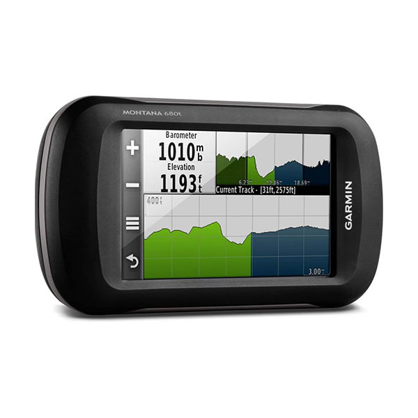
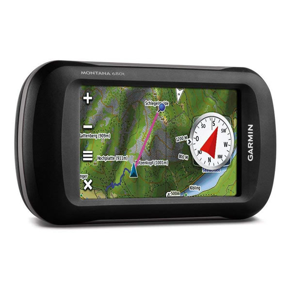
‣Electronic 3-axis compass and barometric altimeter
‣Internal 2.9GB memory
There is GPS and GLONASS satellite technology built-in to the Garmin Montana 680T that will enable you to quickly get a fix on to GPS satellites. Furthermore you will get a good GPS signal in urban areas where there are tall buildings and under heavy tree covered areas.
Geocaching is possible with the Garmin Montana 680T. It stores 250,000 geocaches from geocaching.com and you can do paperless geocaching eliminating the need for cumbersome use of paper and manual entering of coordinates. Simply find the geocaches on geocaching.com and you are ready to go.
Track Manager App is a new feature on the Garmin Montana 680T. The Track Manager App is for you to record, view and analyse where you are on your journey. This maximises the user experience and provides you with more control over the journey taken.
There is an 8 Megapixel camera on the Garmin Montana 680T that not only takes landscape and portrait photos but it also records a geotag providing you with GPS coordinates as to the exact location of the photos taken so you can navigate back to the exact location.
A barometric altimeter tracks changes in pressure to calculate altitude. Plus a 3-axis compass will allow you to find or check which direction you are heading and you do not need to be holding the GPS device level to do so.
You can use the BaseCamp software to view and organise maps, waypoints, routes and tracks. With trip-planning software you can wirelessly share your routes and waypoints with friends, family and fellow explorers. When viewing Topographic maps on your computer you can view contour lines and elevations. Furthermore you can transfer satellite images to your device using the included 1 year BirdsEye Satellite Imagery subscription.
Additional maps and charts are also available for the 680t. Mapping options include: City Navigator street-level road maps, BlueChart g3 marine charts, TOPO map series and GB Discoverer Ordnance Survey LandRanger maps at 1:25k or 1:50k scale. Each of these maps are available on SD/microSD card for use with the Garmin Montana 680t. Furthermore with Garmin’s Custom Maps you can transfer paper or digital maps into your device along with landmarks, points of interest, etc. This is useful with maps such as ski piste routes, mountain bike trails or favourite hiking trails.
The Garmin Montana 680t features a dual-battery system; you can use the rechargeable lithium-ion pack or AA batteries. The battery life is 16 hours with Lithium-Ion and 22 hours with AA batteries making a total of 38 hours.
To use the Montana 680t in varying places other than in the palm of your hand, a number of different mounts are available. These accessories include a handlebar mount ideal for using on a bike, a car mount and speaker for use in-car and marine mount when using on a boat.
Do you have a question about the Garmin Montana 680t or other handheld GPS related question that's not been answered on this webpage? Please see our handheld and Outdoor GPS FAQs page for questions from other customers.Plus if the answer to your question isn't featured, use the online form to ask us for the answer. Alternatively please telephone 01733 777623 Monday to Friday (9:30am-5:00pm) to speak to one of our sales team. For further information online please see the Garmin Montana comparison table.
‣4-inch TFT sunlight-readable, dual orientation, colour, touchscreen display
‣8 megapixel with automatic geo-tagging
‣Built-in recreational (topographical) maps of Europe
‣Stores 10000 waypoints and 200 saved tracks
‣Provides automatic turn-by-turn directions with optional City Navigator maps
‣High-sensitivity GPS receiver with GPS and GLONASS for improved performance and reception
‣3-axis tilt-compensated electronic compass
‣Barometric altimeter
‣Waterproof standard: IPX7
‣2.9GB internal memory for map data and photos
‣Wirelessly share routes, tracks, waypoints and geocaches between units
‣microSD card slot for additional map data
‣Up to 16 hours (lithium-ion); up to 22 hours (AA batteries)
‣Weighs (289 g) with included lithium-ion battery pack; (333 g) with 3 AA batteries (not included)
‣USB
‣2 year guarantee
Garmin Montana 680t is preloaded with a recreational map of Europe (topographic maps for Europe at a scale of 1:100K to 1:250K). Additional pre-programmed Garmin maps on SD/microSD card can also be added including TOPO maps of 1:50K Great Britain, 1:25K Great Britain, France, Italy, Spain, etc. Learn more about the available maps for the Montana 680.
‣Garmin Montana 680t
‣Lithium-ion battery pack
‣AC charger
‣USB cable
‣Manuals
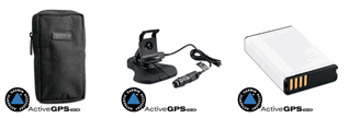
Looking for accessories to use with the Garmin Montana 680t handheld device? We sell a vast selection of genuine parts and spares including Montana 680t carrying case, automotive suction cup mount, marine mount, lithium ion battery and external GPS antenna.
View all Garmin Montana 680t accessories
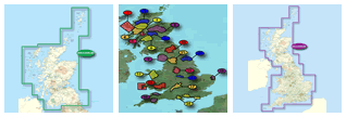
Garmin Montana 680t is preloaded with a Worldwide basemap with shaded relief. However, a number of other maps supplied on SD/microSD Card are also compatible including street-level road maps - perfect for using your Montana 680t in a carcar. Garmin Cycling maps Europe - perfect for cycling on and off road in the UK and mainland Europe. 1:50k and 1:25k Ordnance Survey maps - ideal for hiking and walking the countryside of Great Britain and marine BlueCharts - ideal if you want to navigate the waters around the UK, Europe or further afield.
View all Garmin Montana 680t maps
Question: Could you let me know what scale the Recreational Map of Europe is that is included with the Garmin Montana 680t. Also can I plan off road tracks using basecamp and follow those using the 680t.
 Answer: The Garmin Montana 680t's preloaded topographical map scale varies from country to country. In general the preloaded map is of a 1:100K scale, but in some cases may be larger. Smaller scale country or region specific topographical maps are available separately from the TOPO map page of our website e.g. France can be purchased at a scale of 1:25k.
For information relating to Basecamp I would recommend you speak directly to Garmin UK. While we sell the map, products, accessories, we are not Garmin and do not offer downloads, so cannot provide advice on Garmin's digital services.
Do you have a question about the Garmin Montana 680t? Submit your question via our contact page.
‣Technology: GPS
‣Display: 272 x 480 pixels, bright, transflective 65k colour TFT, dual-orientation touchscreen; sunlight readable
‣Touchscreen: Yes
‣Waypoints: 10,000
‣Routes: 200 saved tracks
‣Built-in memory: 2.9GB
‣Electronic compass: Yes, 3-axis, tilt compensating
‣Barometric altimeter: Yes
‣Data cards: microSD card
‣Battery: up to 16 hours (lithium-ion); up to 22 hours (AA batteries)
‣Waterproof: Yes (IPX7)
‣Dimensions: Width - 74.8mm, Height - 144.2mm, Depth - 36.4mm
‣Weight: (289 g) with included lithium-ion battery pack; (333 g) with 3 AA batteries (not included)
‣Guarantee: 2-year
‣Garmin Montana 680t manual
![]() Manual requires Adobe Acrobat Reader
Manual requires Adobe Acrobat Reader
Download a free copy here
This product is a sophisticated electronic device which requires that you read, understand, and act upon the information given in the instruction manual (usually available via the above 'manual' link). You will need internet access and, in accordance with the manufacturers’ recommendations, regularly seek out and accept all firmware or software updates offered by the manufacturer. All GPS devices need to ‘see’ the satellites in the sky. Therefore you will need to know that your vehicle does not have glass that will block or impede the GPS signal.
Updates to this product are via the internet. At this product page we state compatibility with specific versions of current internet connection devices, for example: PC, laptop, MAC, smartphone etc. The Consumer Contract Regulations allow you 14 days, from receipt of purchase, to check compatibility with your internet connection device/s. If you choose to replace or update your PC, MAC etc. neither we nor the manufacturer will be responsible if the new/replacement Operating System (OS) is not compatible with the purchased product.
We are official Authorised Internet Retailers for Garmin. We sell genuine Garmin products, accessories and maps. We purchase from assigned Garmin UK distributors. We do not buy on the grey market and we do not sell counterfeit products. You can rest assured that by purchasing from ActiveGPS you will receive the full support of Garmin.
Page updated: 7th March 2024
ActiveGPS.co.uk
Customer Service
Telephone Number:
01733 777623
Monday to Friday 9:30am to 5:00pm (UK Time)
Follow us on
![]()
![]()
![]()
![]()
![]()

ActiveGPS.co.uk Copyright © Active Alliance Limited 2005-2024 | Company Number - 05200677 | VAT Number - GB 834 2222 57
Text compiled by and copyright Active Alliance Ltd. Plagiarism software in use - do not copy any of our website text, images or videos.